THE LOCATION OF A NEW TORONTO SCHOOL
The Goad’s Fire Insurance Map of 1913 shows an empty area between Leslie Street North and Greenwood Avenue where a new Toronto school will soon be built.
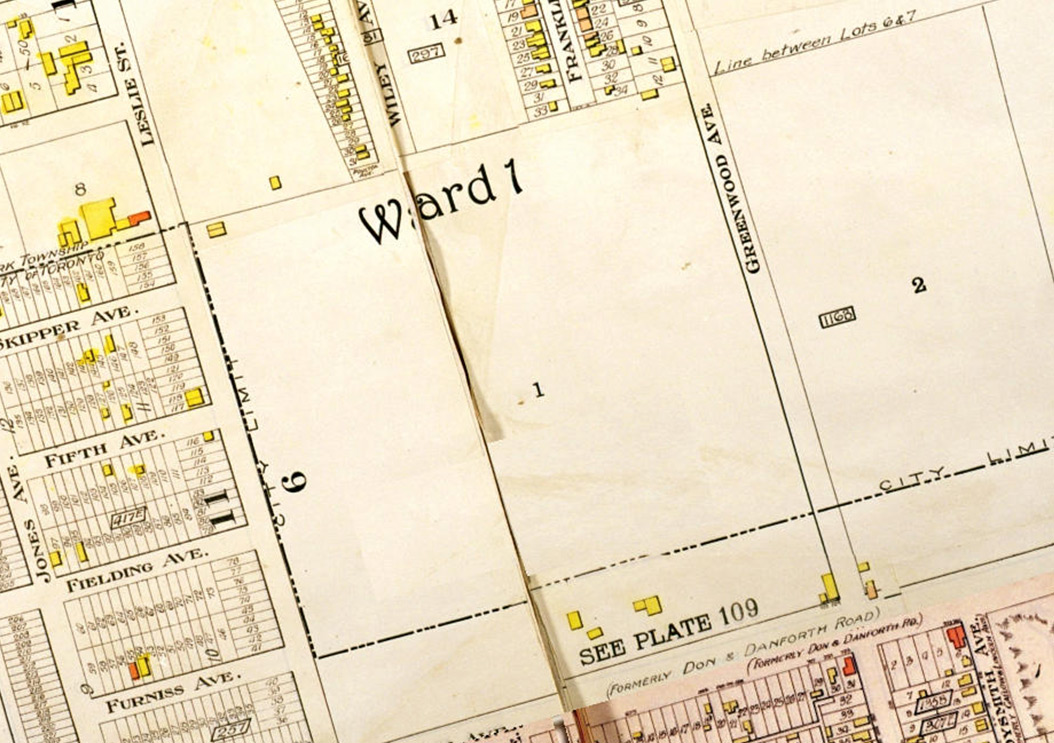
City of Toronto Archives, Goad’s Atlas of the City of Toronto and Suburbs, 1910 revised to 1912 – Detail from Plate 112
NORTH LESLIE STREET SCHOOL OPENS
North Leslie Street School opened in September, 1915 with 337 students enrolled.
WILKINSON SCHOOL GETS ITS NAME
On November 4, 1915 the Toronto School Board decided “that the new school on Leslie Street North be named Wilkinson School after W.C. Wilkinson, Secretary-Treasurer to the Board 1874-1919.” (TBE Minutes 1915)
WILLIAM CARR WILKINSON
William Carr Wilkinson (1841-1927) was a native Torontonian who was appointed as Secretary to the Toronto Public School Board on November 4, 1874. He held this position until he retired 45 years later (!) in 1919. Mr. Wilkinson is remembered above all for his commitment to recording and preserving the history of education in Toronto.
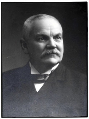
Photo provided courtesy of the TDSB Historical Photograph Collection
DONLANDS AVENUE
In 1915 ‘Leslie Street North’ was renamed ‘Donlands Avenue’. (Thanks to TDSB Archivist Greg McKinnon.)
THE WILKINSON SCHOOL NEIGHBOURHOOD
These pictures show what the neighbourhood looked like around the time that Wilkinson School was built.
The first picture was taken in 1916 on Woodycrest Avenue looking south towards Danforth Avenue.

City of Toronto Archives, Fonds 1231, Item 1229
The second picture was taken in 1917 from Pape Avenue and Danforth Avenue looking south from Danforth Avenue.
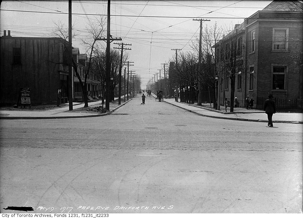
City of Toronto Archives, Fonds 1231, Item 2233
WILKINSON SCHOOL IN THE 1920S
This picture from the 1920’s is the earliest photo of Wilkinson School on record. The northern wing was under construction and the current gymnasium did not yet exist.

City of Toronto Archives, Fonds 1257, Series 1057, Item 270
In this picture the northern wing and fences have been completed.
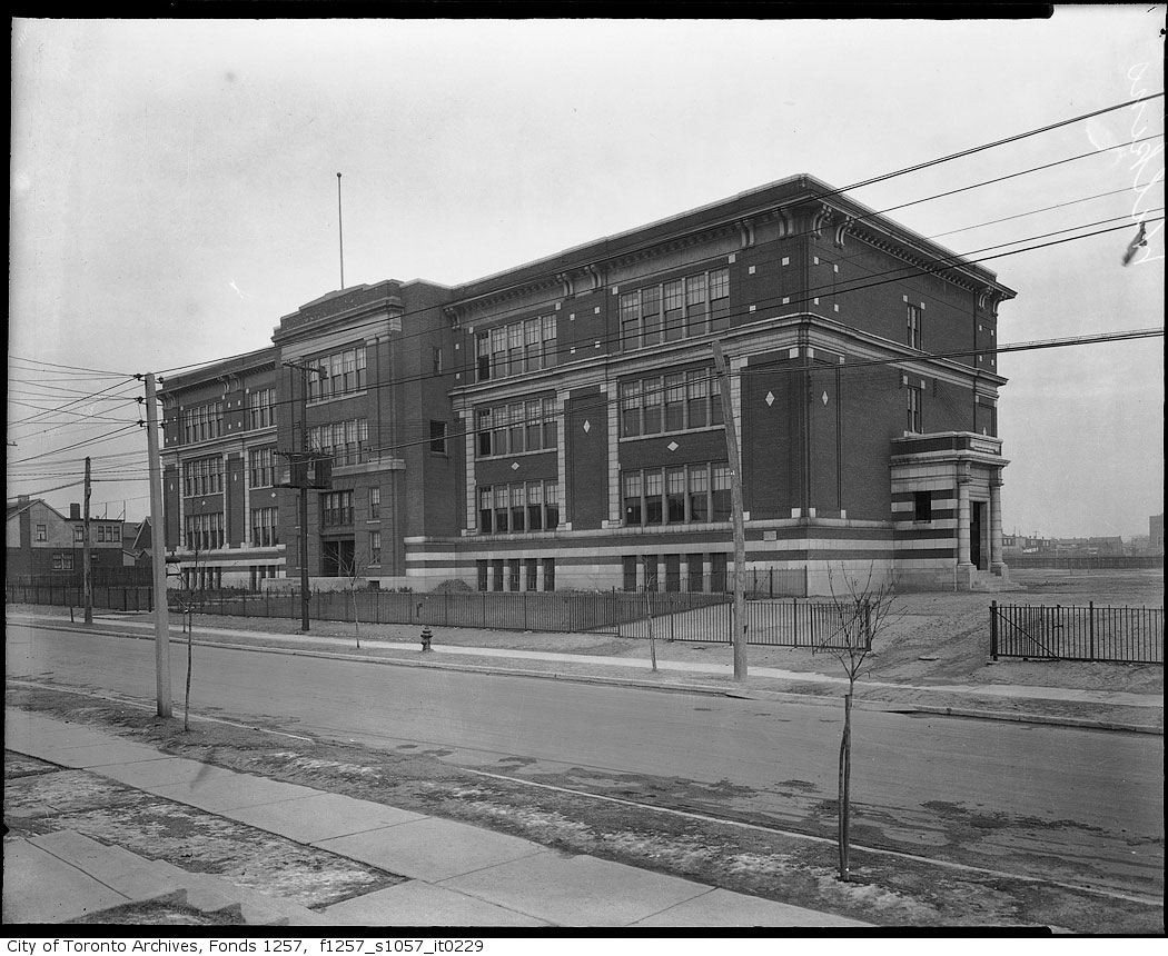
City of Toronto Archives, Fonds 1257, Series 1057, Item 229
A NEW VIEW OF THE AREA
The Goad’s Fire Insurance Map of 1924 shows Wilkinson School surrounded by houses. Riverdale Technical School is also complete, but the two schools are separated by Caithness Ave. This segment of road was later removed and became part of the Wilkinson school field.

City of Toronto Archives, Goad’s Atlas of the City of Toronto and Suburbs, 1924 – Detail from Plate 112
DONLANDS AVENUE STREET WIDENING
In 1948 Donlands Avenue was widened; the following picture was taken in April while this work was being done.
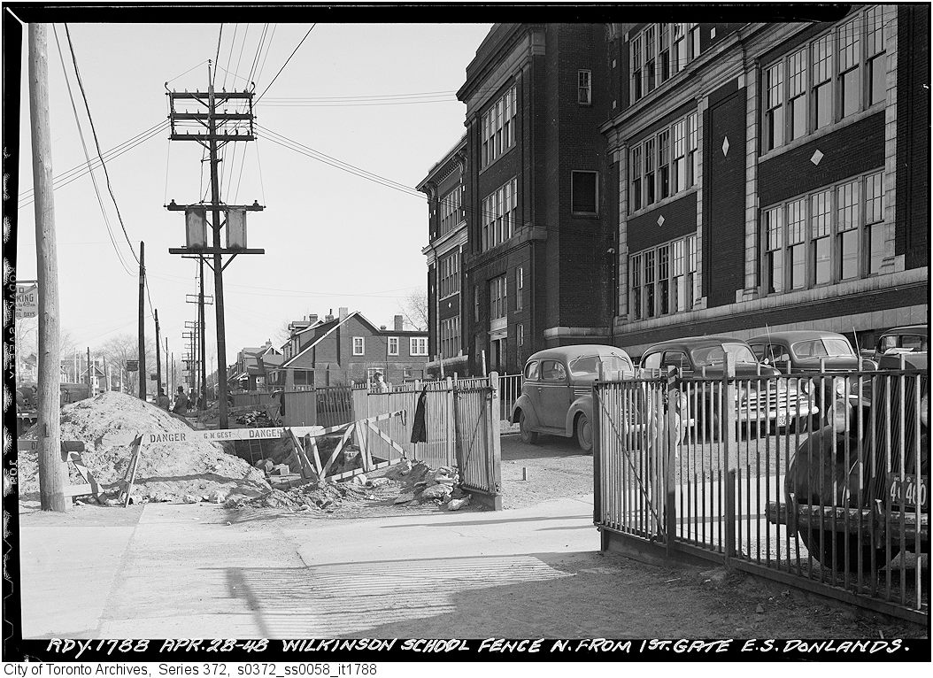
City of Toronto Archives, Goad’s Atlas of the City of Toronto and Suburbs, 1924 – Detail from Plate 112
The following two pictures look north from Strathmore Boulevard toward Wilkinson School. The first was taken before Donlands Avenue was widened.
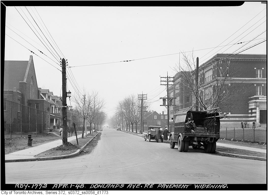
City of Toronto Archives, Series 372, Sub-Series 58, Item 1773
This second picture shows Donlands Avenue after the street widening is complete.
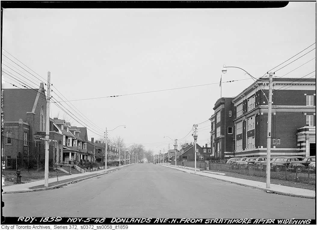
City of Toronto Archives, Series 372, Sub-Series 58, Item 1859
100 YEAR ANIVERSARY
In 2015 Wilkinson Public School celebrates its 100 year anniversary.
All photos are from the City of Toronto Archives and are used by permission.