Ms Welch Media Literacy

Hour of Code

Our students participated in Hour of Code.  They learned basic Computer Science with drag and drop programming.  Students learned through tutorials by Bill Gates and Mark Zuckerberg how to do repeat-loops, conditionals and basic algorithms.  Please visit http://hourofcode.com/co. After one week of starting this program, 16 398 254 students participated, writing 540 318 201 lines of code!

Media Literacy with Ms Welch


In the Media Literacy computer lab, students create a variety of media texts to demonstrate their learning in all areas of the curriculum. They learn to use a variety of media forms, applying appropriate conventions, and techniques. The students use many computer applications and technological tools to complete their assignments.

Grade One

Energy Brochures

The grade ones made brochures about energy uses.  They sorted images into each energy type.


Saving Energy Posters

The students made posters about how to save energy.  They were provided with an image and added details to it.


Mapping

The Grade ones learned to use and make map legends.


The Local Community


Google Maps
 
The grade ones used Google Maps Street View and Smart Notebook software to capture images of community facilities in our local area. They used basic techniques of mapping to paste these images on a map that they drew in Smart Notebook. They then created a quiz, using appropriate words, to describe the relative locations of the places.


Community Helper Who Am I


The grade ones made Who Am I guessing booklets to demonstrate their knowledge of Community Helpers. They used drawing tools to create original images of different occupations and their roles within the community, and they used word processing to write clues about them


.


Grade Two


Features of Communities Around the World – Map, Globe, and Graphic Skills


Google Earth World Mapping


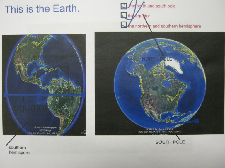
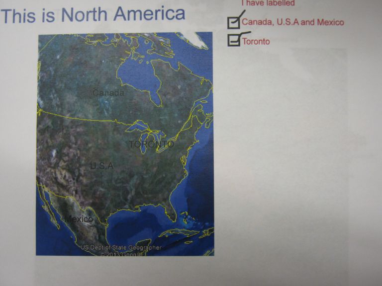
The grade twos used Google Earth and Smart Notebook to capture images of the Earth. They made a mini-book in which they cropped and labelled Google Earth images to show that the world is made up of countries, continents, and regions. The students zoomed in from space to locate and capture Google Earth photographs of the world, North America, Canada, Ontario, Toronto and they landed at Seneca Hill Public School!

Hundertwasser Art by Grade 6