Map with GIS 8
Curriculum Connections:
- Geography - Patterns and Sustainability (Global Population Patterns)
- Media Literacy - Create a Media Text for an Intended Purpose and Audience
Character Development:
- program emphasizes respect, responsibility, teamwork, perseverance and co-operation
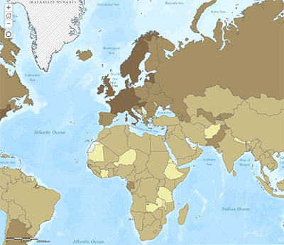
Students begin making and analysing a map of Toronto and their route to TUSC. Using a special web app, they study the cross sectional profile of Toronto and identify creeks and rivers. In the afternoon, they use a world map and add: a population density overlay, and use this to identify conurbations on each continent. The final piece is making a Story Map tour of each conurbation, using the internet to find relevant info and a photo of each urban area.
This program uses ESRI’s latest "cloud" service, ArcGIS Online. This allows using robust GIS tools on any computer, including mobile devices, in a browser. Visiting classes will be given a special account, tied to the TDSB, to create maps at TUSC, and to continue using them back in class. As all the data lives "on the web", students can access and expand their maps from any computer.
This program does not have an outdoor component.
Please Note: TUSC’s IT Lab is fully accessible for students in wheelchairs
Program Length: one day (9:30 am - 2:00 pm)
Availability: winter (December to mid-March)
Location: TUSC IT Lab
Fee: $300.00 per class
User fees help ensure the continuation of these learning experiences through partial cost recovery; fee schedule reflect rates subsidized by the Toronto District School Board.
TTC: each student requires 2 TTC tickets, for travel to TUSC and back to school
Maximum: 30 students